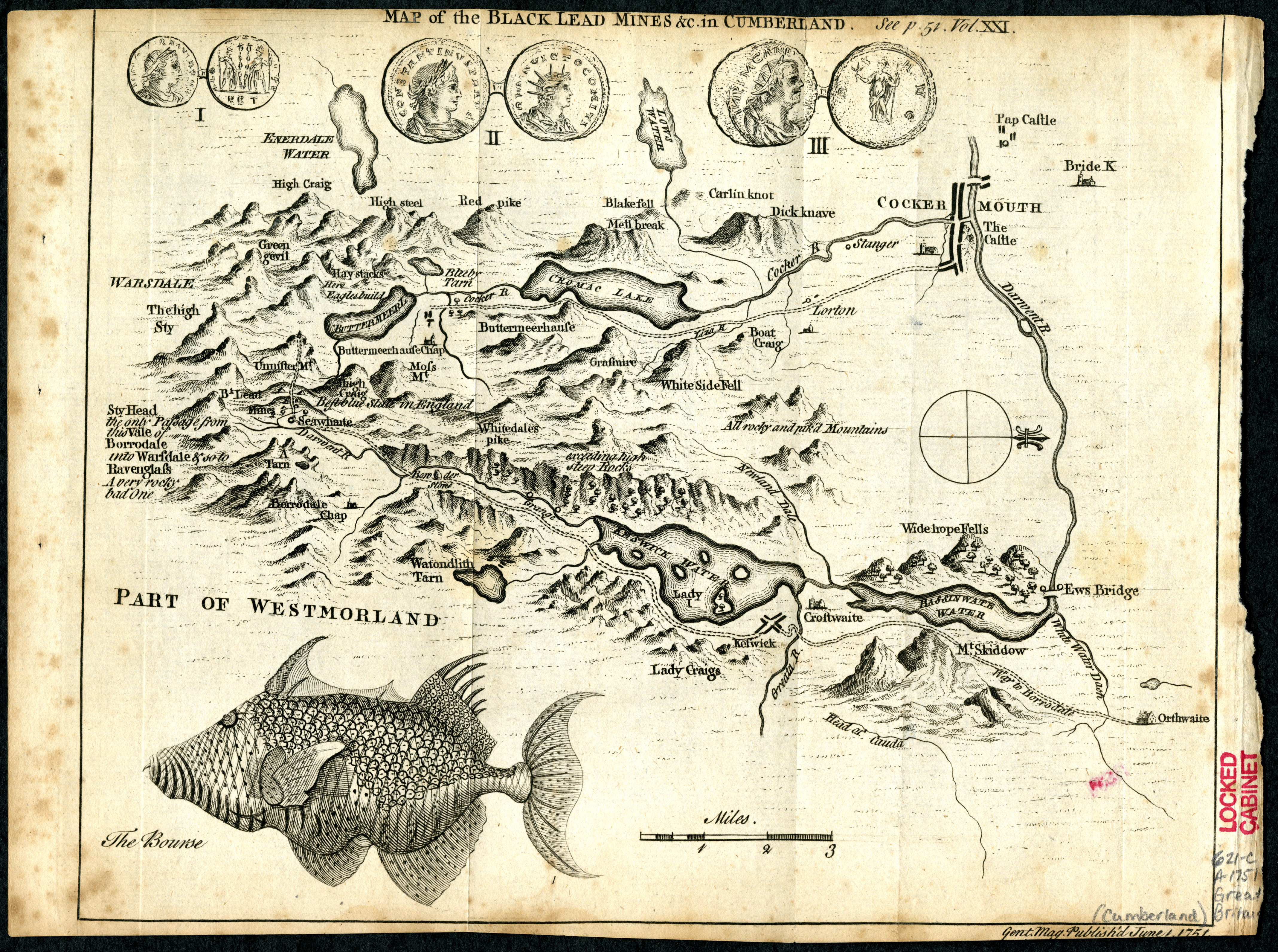
In the Gentlemen’s Magazine for February 1751, p.51, a George Smith describes a journey made in 1749 from Orthwaite (north of Skiddaw) to the black lead (‘wad’, graphite) mines of ‘Unnisterre‘ (Honister). His description is illustrated with a map1 showing his passage south along Borrowdale to ‘Seawhaite‘, and thence to Unnisterre.
Click to enlarge
The writing is evocative in its own right, with the author pronouncing that “the scene was terrifying … … the horrid projection of vast promontories, the vicinity of the clouds, the thunder of the explosions in the slate quarries, the dreadful solitude, the distance of the plain below, and the mountains heaped on mountains that were lying around us desolate and waste, like the ruins of a world which we only had survived excited such ideas of horror as are not to be expressed. We turned from this fearful prospect, afraid even of ourselves, and bidding an everlasting farewell to so perilous an elevation, we descended to our companions … .“
On the left side of Smith’s map, and referring to the pass we know today as ‘Sty Head’ between Borrowdale and Wasdale, a note states: “Sty Head the only passage from the Vale of Borrowdale into Wasdale and so to Ravenglass A very rocky bad one“.
Also apparently labelled, is a mountain named as ‘The High Sty‘. Does this refer to one of the surrounding mountains? No evidence that I can find appears on modern maps. For a while I thought it might have been naming Scafell Pike itself, maybe – which would have been a discovery indeed! In the end, though, after careful study of Smith’s map I’ve concluded the Scafell range is too far off the left side of the map edge for this to be correct.
‘The High Sty‘ is probably just a reference to the pass. “Sty” in Cumbrian dialect can refer to a steep path or pass, especially in upland areas, and High Sty might denote a high mountain pass.
W. P. Haskett-Smith offers corroboration, perhaps? In his 1894 book Climbing in the British Isles. vol. 1 – England, he notes in his entry for ‘Sty Head’ (page 148) that “The natives always speak of the whole pass as The Sty or The Stee“.
Footnotes.
- The map appears on the preceding page in the Internet Archive digitised version of the magazine; and also here: https://lakesguides.co.uk/html/LakesTxt/gm13.htm. ↩︎
END.
