Despite a lifetime of outdoor walking and climbing activities I’m not a natural backpacker. Making a journey on foot with my home on my back is almost alien to me. That’s not to say I’ve never done it but the occasions have been few, far between and of short duration.

Thus, it was with trepidation that I embarked upon my Pennine Way adventure in May 2022. What would this 255 mile 17 day journey bring? Would I be capable? Would I cope? Would I finish it? I set out with the intention of doing so.
The Pennine Way (PW) is the oldest and most iconic of the UK’s National Trails. Starting in the Peak District (Edale, Derbyshire) and stretching north to Scotland (Kirk Yetholm, Scottish Borders) it’s a challenging long-distance walking route along the backbone of England, the Pennines.
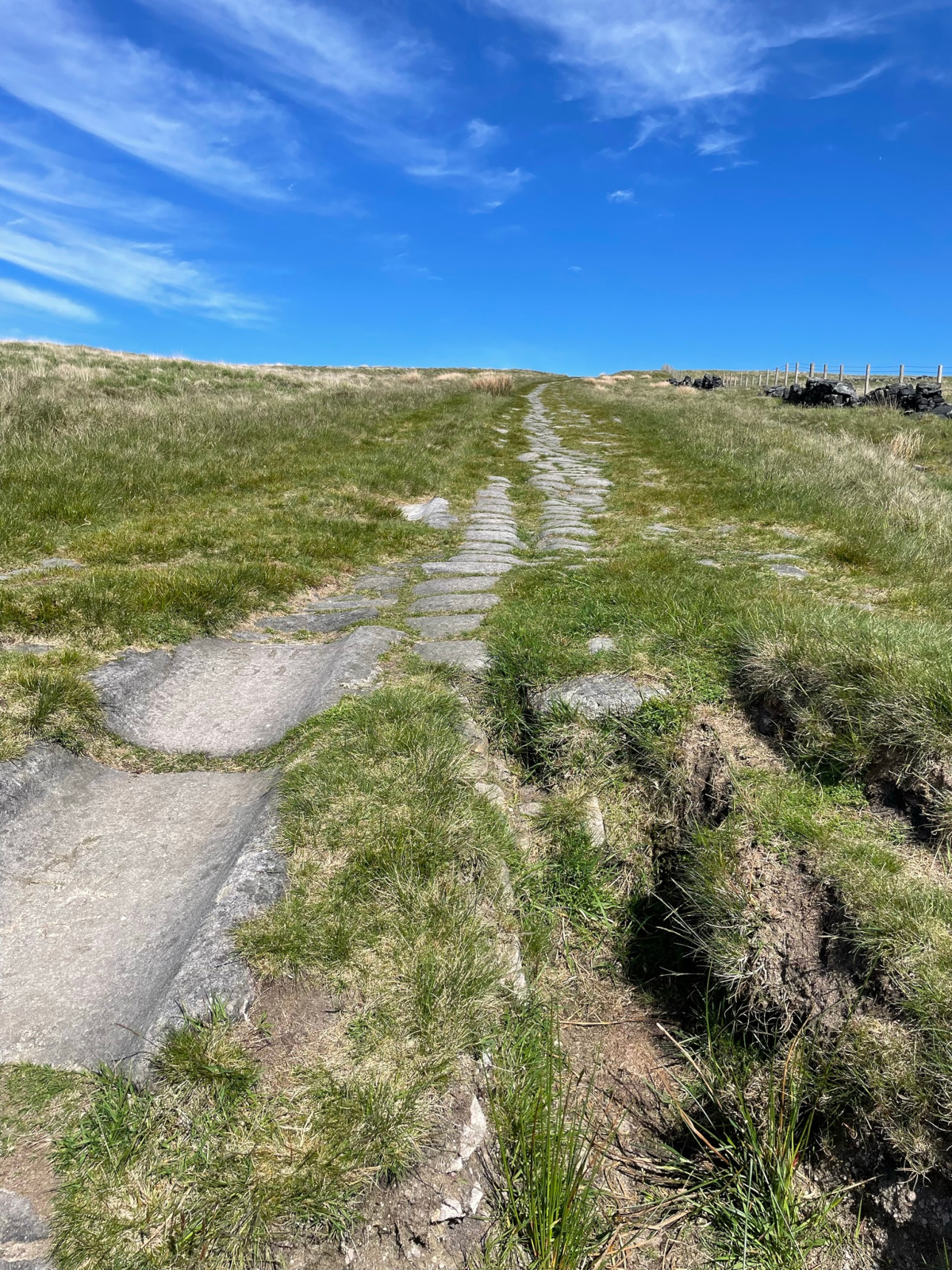
With impressive scenery and pervaded by history, the Way is a hilly route, quite remote in places and with varied terrain. One minute you can be walking on firm, stone paths. Other times you face several hours of wet and boggy ground; although much of that has been improved in recent years with flagstones (themselves of historical interest) laid on many stretches of the Way.
To camp or not to camp?
I’d chosen self-sufficient camping over pre-booked indoor accommodation. This would give me flexibility about when to begin and how long to take. I wanted to choose my weather window and to have the freedom to move as fast or as slow as I wanted or needed to. If I’d pre-booked everything I’d be committing to a scheduled itinerary regardless of weather and my rate of progress. There would be no possibility to take rest days if I needed them or to sit out terrible weather. Self-sufficient camping overcomes those constraints but at a cost. It means a heavier, more-tiring load and the potential risk of being thoroughly wet for several days on end.
With plenty of homework I wrote my plan for the popular south to north walk. Appropriate to me personally, it details each day/section with mileage and the possible camping / accommodation places. I put in details of provisioning points – not only of Way-side pubs, burger vans, and cafes but also the primary towns at Hebden Bridge, Hawes, Middleton-in-Teesdale, Alston and Bellingham where food and other essentials can definitely be found. These towns are each around three days walking distance from one another. Worst case, I’d need to carry no more than three days supplies to avoid going hungry. I also identified places for obtaining fresh water – either mains supply or treatable with a filter and chlorine tablets. I checked and included location grid references and contact details for each place, with alternatives. Even best laid plans go wrong. In all this I was greatly assisted by the reservoir of knowledge that is the Pennine Way Walkers group on Facebook. The accommodation and campings list the group maintains is especially useful.
All I had to do now was wait for the nice weather and buy train tickets to Edale.
Setting off
As I set off for Edale in May 2022, I felt a mixture of excitement and anxiety. I was looking forward to the walk but despite my planning, and familiarity with several sections of the trail, there were still unknowns. I was unsure how everything would unfold. Would I manage the walk day after day? I’d never done such a big walk before. What unforeseen difficulties would I find? Would I starve? Would the bogeyman get me?
Walking each day I soon settled into a kind of rhythm and routine. Short, somewhat sleepless nights with early daylight led to early starts each morning. The sun is rising and warming. The light is pretty. Birds are singing, views are ever changing. It’s good to be alive and out on the Way. I’m actually doing this thing I’ve been wanting to do for the last 6 or 7 years. This, despite having said throughout most of my adult life that I had no interest in doing the Pennine Way. What changed?
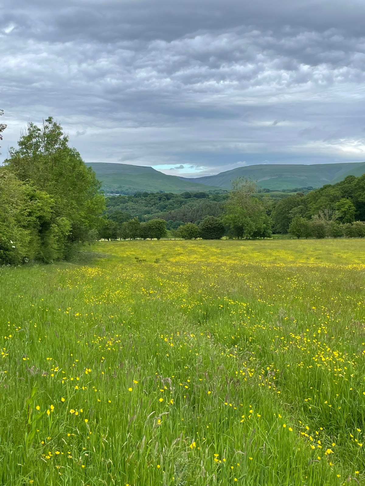
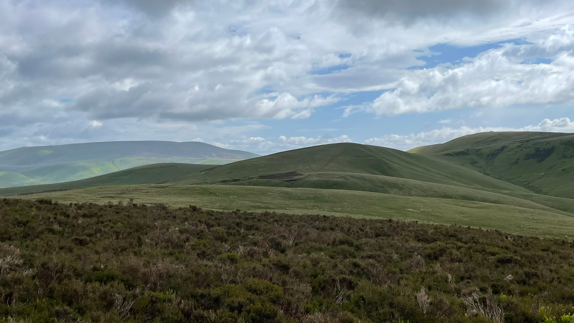
I pass over many moors, dotted with reservoirs serving the great metropolises of the North. Views over Greater Manchester to the west in the first days. Later on, West Yorkshire to the east. There’s hardly anyone about. In fact, I’m surprised by how few PW walkers I meet or pass during the first days – only 3 or 4. I make good and steady progress, stopping often to take photos that make memories.


Reaching Crowden was the first milestone. Marking the end of the first day, it’s considered a tough start at 16-17 miles, with rough going underfoot in places. Some walkers have been known to bail out after this first day.
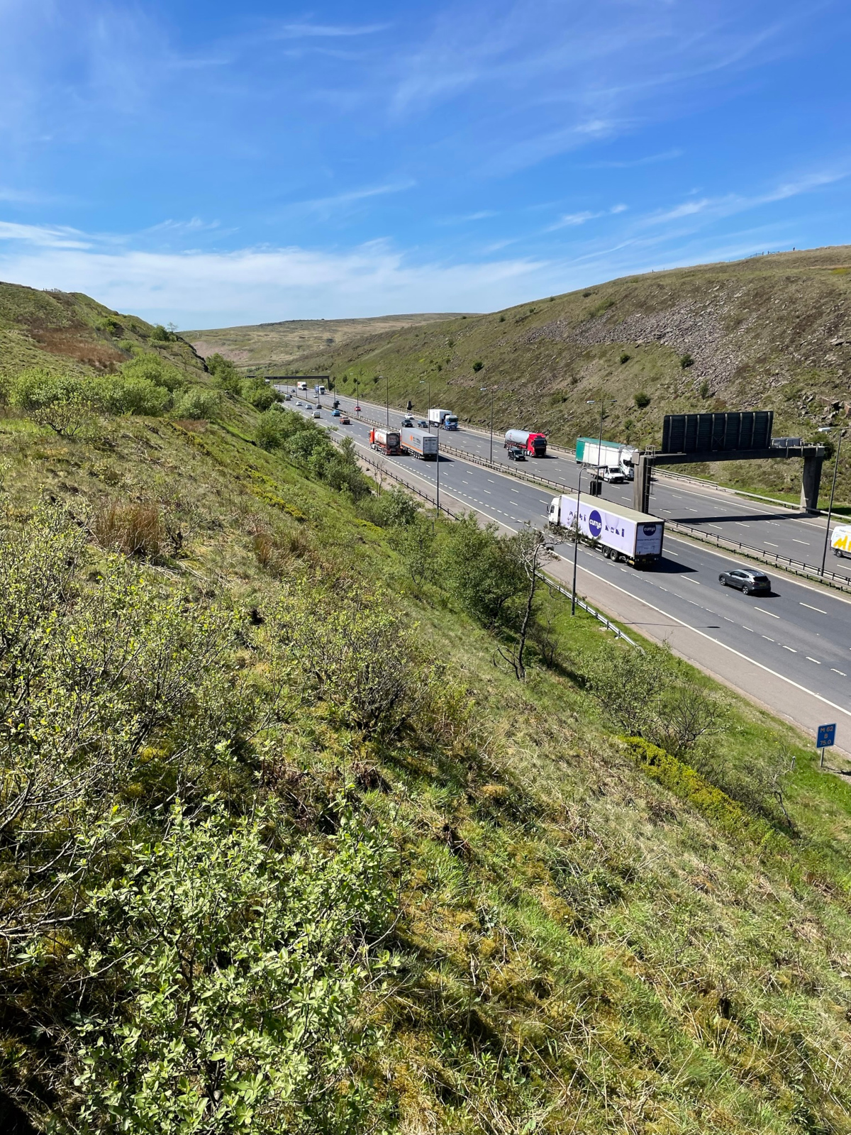
Crossing the M62 felt like another important moment. I was moving out of the familiar Peak District and into new (to me) unfamiliar West Yorkshire. Walking from Crowden, over Laddow Rocks, Black Hill, Wessenden Head, Standedge, White Hill, M62, Blackstone Edge, The White House (pub), Warland Reservoir, Stoodley Pike, Rochdale Canal – all was new and pleasant. The weather was fine and sunny, even hot in the afternoon. I pretty much missed Heiden Bridge, finally stopping beyond at Jack’s Bridge / New Delight Inn, just short of Colden. I was too late for pub grub.
Blackstone Edge


Day two at 28 miles turned out to be my longest and hardest day. Passing Standedge at midday, and Blackstone Edge mid-afternoon, it felt too early to stop and kick heels. My intended camping spot at Old Chamber was closed. My mistake! It seems to be open only at weekends. By the time I reached Jack’s Bridge, it’s fair to say I was beat, pooped, knackered, worn out. But it had been a good second day. In hindsight this day caused me problems.
Two easier but no less interesting days followed in the South Pennines, passing Walshaw Dean Reservoirs and Top Withens (Wuthering Heights) to reach Ponden Mill; and then across Ickornshaw Moor, Lothersdale and Pinhaw Beacon. This was also new territory for me. Again, I saw hardly anyone walking the Way. Only occasionally did I bump into local villagers and dog-walkers where I’d say ‘hello’. Eventually I reached Gargrave, a village I’ve driven through many times but never walked through. Gargrave, late on a Saturday afternoon / evening provided a nice rest, allowing a bottle of wine and a newspaper read.
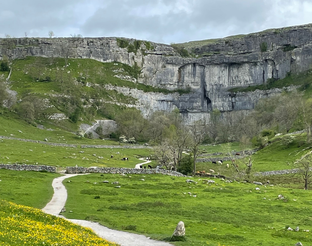
Beyond Gargrave, with my partner joining me for a couple of days, we had Malham Cove almost entirely to ourselves early on a Monday morning. There’s no doubt that’s a more spectacular place when no-one else is around. Malham Tarn, Fountains Fell and Pen-y-Ghent were all familiar ground. And again we saw hardly anyone. Although the PW doesn’t cross the summit of Fountains Fell, we made a short diversion there and also to Fountains Fell South Top for my partner to ‘tick her Nuttalls‘.
On the next leg from Horton to Hawes we again diverted for my partner to gain a tick for the summit of Dodd Fell Hill.
Seven days walking took me/us as far as Hawes. While all began well in Edale, discomfort in one of my hip joints on day three developed to pain and limping. I put this down to the 14kg load I’m carrying on my back and a foolishly long day two. After a couple of light load days and a full rest day I tested the hip again with a full load – up a stony track for a mile and back. Too painful. The forecast of upland gales for the coming two days across Great Shunner Fell, Keld, Tan Hill and Sleightholme Moor was sufficient to further lower my resolve. I knew I should take a break, suspend my walk, return home and recuperate. I’d come back in a few weeks time, after resting, to pick up where I left off.
Sunny September?
Fast forward three months to September 2022. I’m stepping off the train at Garsdale station to ride the Little White Bus to Hawes and camping in the garden of the Hostel at Hawes (formerly the YHA hostel). There’s a spell of reasonable September sunshine to come, … apparently. I’m rested, back and ready to go. Setting off next morning, Great Shunner Fell is grey and Rukins campsite at Keld is damp and midgy. Dinner is a massive cheese salad roll and Bakewell slice. Tan Hill, Sleightholme Moor and Baldersdale next day (day 9) are sunny. Crossing the Greta Valley / A66 is another significant milestone for me along the Way although the constant traffic noise rather spoils that section. God’s Bridge, whch you might imagine should be a peaceful place, isn’t. Hannah’s Meadow, on the other hand, is. By the time I’m pitching my tent in Middleton-in-Teesdale, it’s raining.
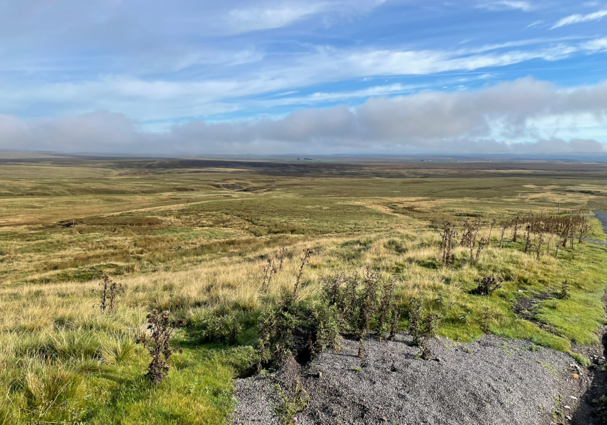
Sleightholme Moor often gets mentioned in accounts of Pennine Way journeys for being persistently wet and boggy. It has a reputation, being one of the few parts of the modern route where flagstones are conspicuously yet to be laid. After the Intake Bridge though, we come to Bowes Moor and Cotherstone Moor. They hardly ever mentioned. People usually just say ‘we crossed the A66’. These moors are wide open and expansive, with little in the way of prominent features. Worked as grouse moors, they nevertheless retain a particular beauty of their own in late summer when the heather flowers, the grass waves in the wind and the sun shines. I love the sight and sound of the Red Grouse, disturbed and taking flight as I pass by. Surprisingly in these uplands there are a few stray pheasant as well. As I cross the road before the ‘tuck shop’ at Wythes Hill Farm, the tranquility is spoilt by the noises of many scrambler motorbikes roaring (illegally) across the moors for their Sunday afternoon entertainment.


Sunday evening in Middleton could have been better. The only place in town serving sit-down food at that time was the Teesdale Hotel, with an almost two-hour wait for service. So for me, it was takeaway pizza on a bench under a tree in the rain, watched by a knitted cow. Now there’s a rare breed you don’t see everyday.


The next day, Monday, walking to High Force, Cauldron Snout and crossing the Pennines by Maize Beck to High Cup Nick and Dufton becomes wetter, colder and more miserable – although it’s a less wet day than forecast. What a positive! In any case, this is a long and remote stage. Low Force and High Force come and go. I’ve seen them before. Above Sayer Hill Farm a field of Belted Galloways, including a bull, bars my way. They’re standing around and across the path so it’s fortunate I can climb over and walk the other side of an electric fence. Treacherous terrain across greasy rocks at Falcon Clints, where a slip with a heavy rucksack load could easily lead to ankle injury, is slow going. Why is this still the official route? By the time I’m up Cauldron Snout it’s raining persistently. I discover my £300 very high tech breathable waterproof shell jacket isn’t waterproof at all. I’m only halfway to Dufton.
Arriving bedraggled and wet, I sit on the step outside Dufton YHA and make a phone call. They have a room. I’ve had a guts full. Tonight I spend in the hostel and The Stag Inn across the road. I’m enjoying the walking on one level but I’m not finding it relaxed and leisurely like I expected. No leisurely breaks in cafe’s, no lunch time pub stops. It was too early at Tan Hill and I didn’t want to go via Bowes. I’m too anxious — more so than I was back in May — about what’s coming ahead and about getting to the end of each day’s walking. Perhaps it’s because the sun is setting earlier? I’m just pushing on, wanting to ‘be there’, rather than taking my time and enjoying it. I’m anxious to avoid wild camps. I prefer the comparative luxury and friendliness of an organised campsite. But these are long stages now, becoming increasingly remote. On the other hand, I don’t want to give up because there’s a couple of days of good weather next. I’m conflicted but I’m put on the spot so I make my decision. I’m not ready to lug my sack and myself over Cross Fell and on towards Hadrian’s Wall. This September return isn’t as pleasant as the first week was back in May and there’s still 7 or 8 days to walk. My head is not in the right place. I’d be pushing on because I said I would rather than because I want to. I need a new plan to make the remainder of the Pennine Way more enjoyable for me. On Tuesday morning, in full sunshine, I take a taxi to Penrith Station and catch a train. By the time I’m reaching home I’m kicking myself.
Coming back again
Twenty months pass. The right weather window didn’t open for me in 2023, so now it’s end of May 2024. There’s a window of fine weather in two days time. I’ve got my mojo back, a revised plan and I’m fit and ready for the PW again. I really want to finish it now. I buy the train tickets.
I catch a train to Appleby. That’s a bind because it’s the day after a freight train derailed at Shap. I have to take the longer rail route to get there. It’s late in the afternoon as I set off to walk the four or so miles to Dufton. But this is already a delight. It’s pleasant walking in the early evening. I surprise a hare at close quarters, watching as it scampers away across a field of long grass and buttercups, with distant view towards High Cup Nick.
After dinner in The Stag Inn, I was lucky enough to catch a mix of soul and jazz entertainment at the village hall with renowned saxophonist Snake Davis. A completely unexpected delight before bed and my next day of restarting PW walking.


The arduous climb out of Dufton, into the Helm Wind, to ascend Knock Fell takes a while but eventually provides a nice view of Great Dun Fell with its CAA radar station. Foggy cloud arrives again, giving a largely uninteresting traverse towards Cross Fell. At the summit there’s a cross-shaped shelter offering protection from wind of any direction. I’ve been here several times before. The boring Corpse Road leads to an overnight camp stop at Garrigill Village Hall. My lasting memory of the Corpse Road is not from this day but of a very hot day in 2021, when my partner and I walked to Cross Fell and back with temperatures in the high twenties centigrade. Fortunately it wasn’t so hot this time. The restored Greg’s Hut looks great.
Passing through Alston (reputedly England’s highest market town, although Buxton in Derbyshire also claims to be) and seeing the South Tynedale Railway with its buffet car cafe at Slaggyford (muddy ford!) delivered a pleasant Saturday. More moors and I eventually turn into the fabulous Greenriggs Cottage campsite. A very pleasant late afternoon/evening is spent sitting in the sun. So far, so good. Everything is going much more nicely than before.
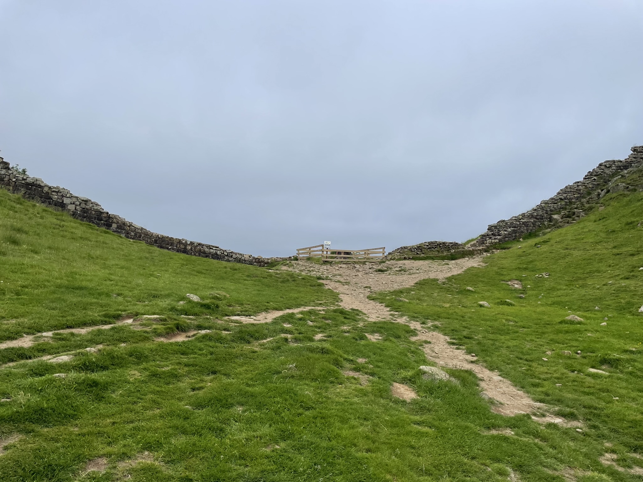
And so it went on. Two nicely sunny days took me along Hadrian’s Wall, with a night at The Sill. Staying there was something I’d wanted to do since the new hostel opened in 2017, replacing the former Once Brewed hostel on the same site. Also staying in the hostel was another man dressed like me. He was wearing the same Montane top and trousers as me, drinking the same beer as me, eating the same meal as me, and reading the same book as me (Extreme Eiger). And no, I wasn’t looking in the mirror, wasn’t hallucinating, and wasn’t drunk. How spooky was that? I should have said ‘hello’ to him and had a shared laugh
It was sad to arrive again at [No] Sycamore Gap and see for myself how the place looks without its iconic tree. We all heard of this on the national news but seeing it for oneself makes me ask: where do people get their stupid ideas from?

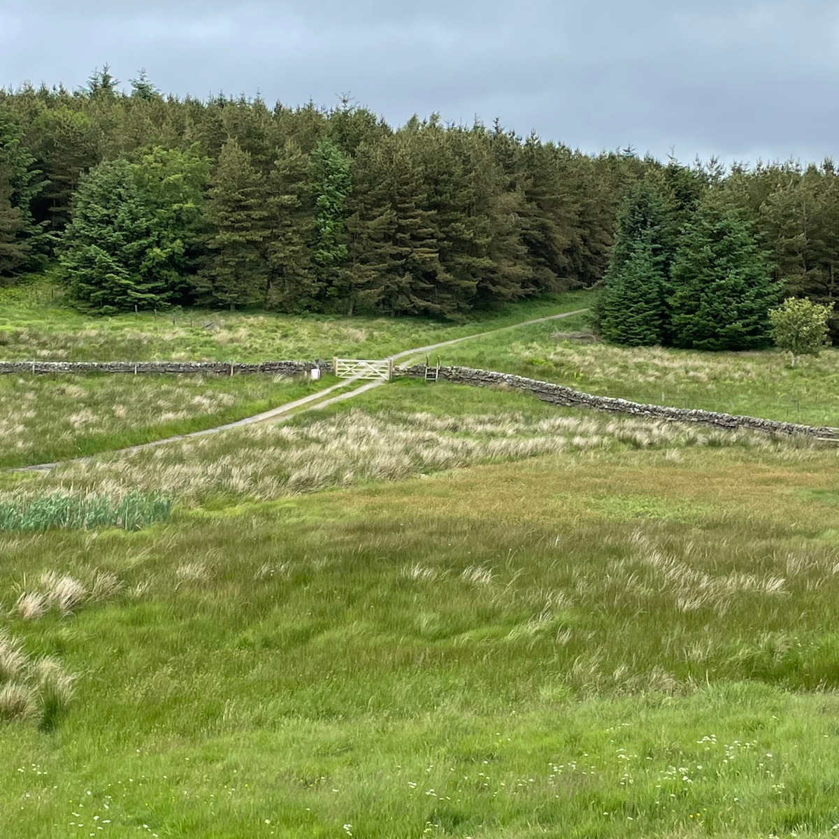
‘North of the Wall‘ it’s a different land. The character changes to wide-open green rolling hills that are alternately moorland and swathes of plantation forest. No less dramatic, it’s pleasant and relaxing countryside on days of blue skies and sunshine but bleak and miserable on wet days. Unrelenting for 32 miles from the Wall to Byrness, the Way is broken only by the small market town of Bellingham mid-way. Pronounced ‘Belling-jum‘ by locals and ‘Belling-hum‘ by almost everyone else, the town provides all a PW walker needs in the way of guaranteed eats, beer, groceries and other items. It allows a stock up for the final two or three days.


Bellingham to Byrness was windy and wet – wet in the air and soggy underfoot. But the sun soon came out again and a great night was had at the Forest View Walkers Inn in Byrness, albeit camping in their back garden. Nevertheless, comfy chairs and very pleasant company of other walkers at communal evening dinner made for a lovely stay. Hosts Oliver and Laura go above and beyond for their guests.
Unable to sleep, early next morning (day 16) saw me start on the final leg of my journey to Kirk Yetholm, first gaining and then following the key border ridge that separates Scotland from England in the Cheviot Hills. Setting off at 04:30 meant I caught the sun rising. After the Roman camps and water re-supply at Chew Green, the emergency refuge hut at Yearning Saddle came and went by 08:45. I stuffed my face here, having had no breakfast.


Soon, the view northeast towards Windy Gyle and The Cheviot appears.
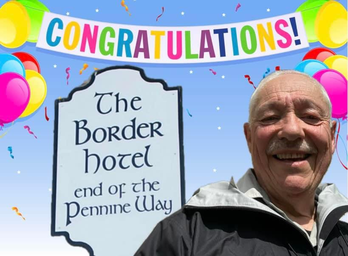
Windy Gyle summit is a welcome halfway milestone. Hen Hole later, and the Auchope Refuge (lunch at 14:00). After The Schil (no photo) I expected the going on the last miles to get easier but it didn’t. The high level main route (the original route) delivers several short but stinging ascents to my tired body. Finally, here we are, at the Border Hotel in Kirk Yetholm – the end of the Pennine Way and my Pennine Way. I had begun my third, comeback, stage in Dufton six days earlier. Today, my final day I walked 27 miles with 6,200 feet of ascent in a little over 12 hours. Wonderful! And I’m feeling pleased with myself.


Looking back
Looking back through notes I made as I walked and the photographs I took, several things strike me about my time on the PW.
First, the Pennine Way is stunningly beautiful. Spring and early summer is definitely the best and easiest time to walk the route. Walking the moors on a sunny day is just delightful. The paths are not yet overgrown, the bogs are drying out, and the views are fabulous. There’s scenic interest the entire way. The spectacle of Lapwings calling and wheeling acrobatically through the sky is wonderful to hear and see. Wild flowers are at their best, lambs gambol in the fields and plentiful rabbits scamper in all directions as humans approach. The occasional hen harrier swoops low across the moor.
Passing through a gate into a meadow early one morning I saw a fox. Tail towards me and tensed, ready to spring, he was watching something in the grass. He didn’t notice me and I stood quietly for what felt like many seconds. He sprung, missed, turned and with some surprise realised he was not alone. For a moment he didn’t know what to do but then bounced off into the woodland. A youngster by the look of him/her but lovely to see from less than twenty feet away. No photo, sadly.
Moments like that added huge value to my days.
Something intrigues me though. Why are some parts of the route photographed and mentioned frequently whereas other equally delightful parts hardly ever get mentioned at all? They do deserve to be.
Second, I had it mainly easy with the weather. I was able to choose when I began and was lucky to have mainly dry weather for most of the three times / 17 days I was on the Way. Following the progress of others in the Pennine Way Walkers group, I see this is often not the case. Many have wet and windy walks. Others have very hot walks. I was twice lucky, being able to both choose when to walk and having a flexible itinerary. It provided a better experience.
Delightful moments of human contact
The friendliness of people I encountered all along the Way was the third striking aspect. Saying ‘hello’ with local people passed by, a short chat about the weather or confirming that I’m walking the Pennine Way, welcomes at campsites, hostels and pubs, or just comparing notes with other walkers: Many of these moments of human contact were delightful and engaging. Just occasionally there was something more interesting:
- A smallholder near Alston says, “Hey, keep an eye out for my peacocks!” He tells how he raised them from chicks, thought they were totally tame, and then released them to his land. He swears he still hears the peacocks everyday but hasn’t laid eyes on them in months!
- At the South Tynedale Railway, the volunteer station master beams with pride as he tells of how he used his professional helicopter-flying skills for delivering flagstones to the top of the Cheviots. Those flagstones really spruced up the whole boggy hill experience.
- Stewart and his two trusty canine companions were on a peculiar northbound journey by walking south. Each day, he bid farewell to one of his two vans along the Way and sauntered south to the other van, which he would then propel further north to leapfrog the first van. In this fashion, he’s completing an epic trek from Lands End to Cape Wrath. Crossing paths with him three times in four days, Stewart generously treated me to a beer at the Border Hotel in Kirk Yetholm on the evening of my triumph. Our chatter revolved around our shared love for camping, hiking, and climbing. We found common ground amidst our own adventures.
- “If you see the walker who was staying here last night, tell him he left his mobile phone charger behind.” That walker was a man I encountered several times over a few days. I left him a Facebook message. I hope he got his charger back.
Other times I encountered not the humans themselves but their thoughtfulness – like the honesty shop for snacks at Wythes Hill Farm, or the Horneysteads Pit Stop where the owners provide table and chairs, kettle, tea, coffee, milk and various sweet snacks – even a bed – without charge (donations gratefully accepted). Tales abound of the daily friendliness, kindness and support that local people show towards many who walk the Way.
The snack van on the A635 at Wessenden Head, the Windy Hill Snack Shack next to the M62 crossing, the Little Buffet Car at Slaggyford Station, and the many other cafes, pubs and places along the Way where sustenance and human contact can be had are all legendary. The Old Nags Head in Edale and the Border Hotel in Kirk Yetholm hold special significance, being at each end of the Pennine Way.
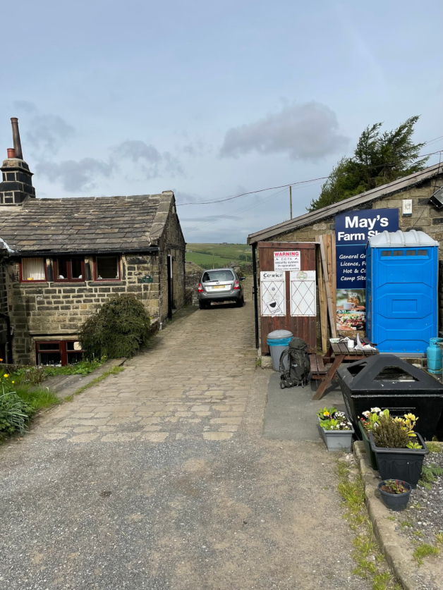
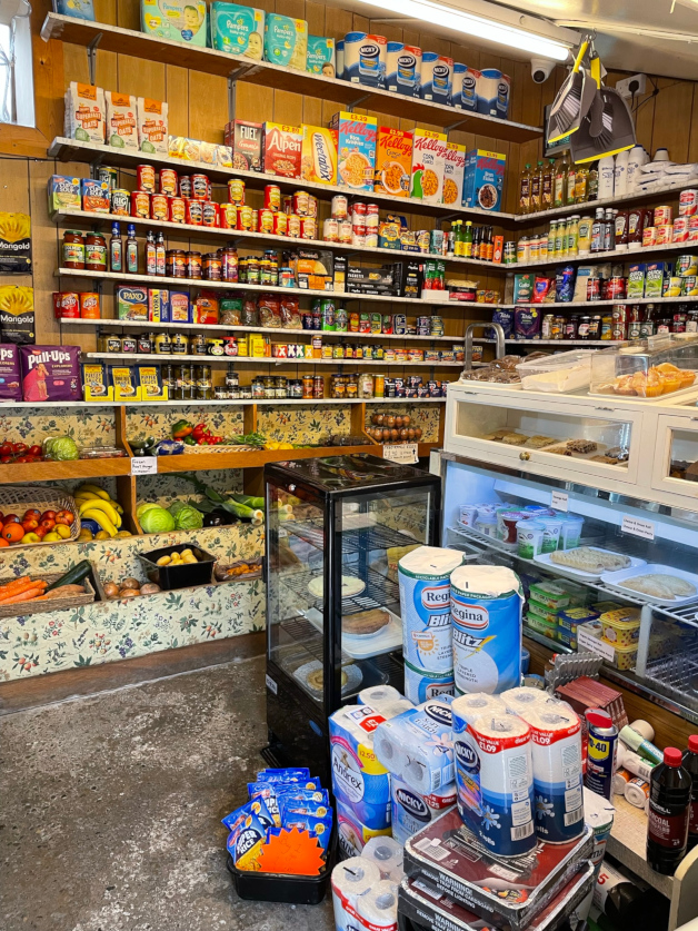
This is to say nothing of the well-stocked May’s Shop at Colden where I consciously chose to stop a while with a mug of tea, a cheese salad roll and the morning’s newspaper.

Camping at Greenriggs Cottage was a delight, as was camping at Ponden Mill. At Greenriggs, on a gloriously sunny afternoon and evening the owner provided mugs of tea, choccy biscuits and conversation to set the world to rights. At Ponden Mill a gushing German couple touring in their motor-home handed me a tin of 7.9% Perlenbacher Strong beer they’d bought with them from home.

Ponden Mill

I already mentioned Oli and Laura at the Forest View Walkers Inn in Byrness. They are to be commended. And at the Friends of Nature hostel in Kirk Yetholm I was welcomed too by the voluntary wardens who themselves were staying just a few days. When I expected to share a dorm, they were kind enough to let me have a room to myself.
What did I learn?
You don’t know what you’re capable of until you try is an old cliche but nevertheless it’s true and often relevant. It’s given me great pleasure to reach the end of my adventure and to know now that I can do it. And that I can do it again if I choose to. Also to learn that I can actually backpack for multiple days.
Planning and preparation pays off. It minimises the possibility of nasty surprises and boosts overall confidence for the adventure. A bit of uncertainty enhances performance but total uncertainty and the fear that comes with that are debilitating. Nice surprises along the way will invariably happen and add greatly to the enjoyment.
If you have the luxury, wait for the nice weather window. It makes such a difference. This means adopting the camping approach as most accommodation gets booked up very early. Some places must be booked at least six months or more ahead to get the best choices closest to the route. At the end of some daily stages the choice of accommodation is very limited. Camping, on the other hand is possible on recognised sites at regular intervals along the route, and there is always the wild, leave no trace option to fall back on.
Minimising rucksack load is crucial, especially if you’re camping. I aimed for no more than 20% of my own body weight, having read that elsewhere as a guideline. Water and food will probably then contribute a quarter of that. I was hindered by the base weight of my rucksack (1.8kg) and the weight of my sleeping bag (1kg+) both of which were heavier than I would have liked. Although I invested in a lightweight tent, sleeping mat and cooking items, it would have cost me much more to do something about both those heavy items. I lived with them. Battery power-packs are heavy too but essential if you rely on tech. As well as my phone and GPS units, I did also carry a paper map book. In the end I lugged about 14kg along with me. You need less clothes than you think.
In the early stages, I carried food I didn’t eat. Taking no chances I planned self-sufficiency for three days at a time, notwithstanding that I could find cafes and pubs along the way. When I could I opted for a pub or cafe meal rather than eating what I was carrying. This left me carrying food I wasn’t hungry for. On the other hand I also bypassed some food opportunities. Later on I planned better in advance where and what to eat so carried less.
Savoury foods made up only a part of what I ate during the day whilst walking. Keeping savoury stuff cool and safe is difficult in summer. Hard cheese is a good choice. It can survive a couple of days without refrigeration. Nuts and fruit are also good, although both are heavy. The skin of a banana weighs as much as the fruit inside. It’s difficult to buy in small quantities. You can start from home with a sandwich and an apple or two but buy in a supermarket along the route and the chances are that apples come in packs of six. Malt loaf is good.
Finally, on the lessons, take trekking poles with you. Know when and how to use them and when to carry them in your hand. You don’t need poles on the flat. And if, by bad luck, you twist an ankle (I didn’t) poles will help you get out of a tricky situation.
No interest in the Pennine Way – what changed?
Why did I do it, when for most of my adult life I’ve shown no prior interest? I even went so far as saying on multiple occasions that I’d never do the Pennine Way. Why?
Several reasons:
- Historically the PW is famous for its poor weather, lamentable paths, and muddy bogs. The original route over the Kinder plateau, right at the beginning of the Way had a particularly fiercesome reputation.
- Because I’ve never really had a strong interest in backpacking. That’s alien to me. My limited experiences in earlier life with make-do heavy gear were that backpacking is hard, wet work. I found it off-putting in the main.
- Growing up, living and working in the South I rarely visited the Pennines during the first half of my life – with the exception of Malham Cove and Goredale Scar visited as teenager on a school field trip. Family holidays were taken on the coasts of Southern England and North Wales, not in the North of England.
However, weekends and holidays in more recent years have been spent peak bagging, biking and being a tourist in the Peak District, Yorkshire Dales, North Pennines AONB and Northumberland. I have gradually become more familiar with this upland region. I’d come across and walk short sections of the Way whilst Nuttall ticking with John. With extensive path improvement, the quality of walking the Way today is the best it’s ever been and significantly different from the experiences of the 1970’s, 80’s and 90s. Eventually I began to think that I needed to join up the parts I knew and see what the in-between parts look like. Thus, an ambition gradually took shape.
In the main my walk was hugely enjoyable, if hard work on occasion. My adventure was demanding yet rewarding. The scenery was mainly fabulous, the weather was mainly good, the camping spots were mainly lovely and the people I met were interesting, friendly, and helpful. I’ve been left with a vivid memory of a journey well made. But there is also that niggling dissatisfaction of failing to finish my walk as one single journey over consecutive days.
Shall I repeat it? Let’s see.
END.

Meeting your doppelganger, Alex… That bit’s given me chills. Great write up and a great achievement.
LikeLike